
REVIEW · MEXICO
Trekking Through The Volcanoes
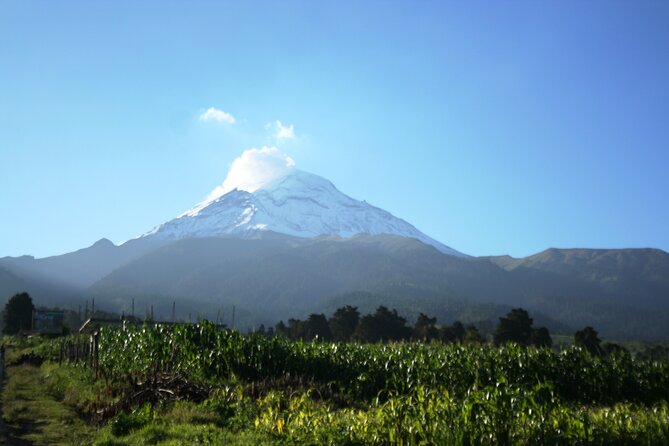
Popocatépetl may be the active volcano, but the real reward here is the quiet route between it and Iztaccíhuatl, Mexico’s Sleeping Woman. You walk through pine forest, high mountain grasslands, ash-covered paths, and rocky ground, with big views whenever the clouds cooperate. Carlos, Bernardo, Alan, and Sergio are among the guides who lead this trip, though your guide depends on the date.
I like the small maximum group of 13 and the fact that poles, a backpack, snacks, drinks, and lunch are included. I also like the finish: tacos and quesadillas at a traditional market rather than a bland tourist restaurant. The main catch is altitude. This is not a technical climb, but the thin air, 9 to 13 km of walking, steep pitches, dust, and a long drive make it a serious day outdoors.
Key points to know before booking
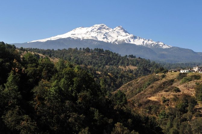
- You walk between two volcanoes: The route begins at Paso de Cortés and reaches viewpoints toward Iztaccíhuatl and smoking Popocatépetl.
- The altitude matters more than the trail: The hike gains roughly 300 to 400 meters, with sections around 3,500 to 4,000 meters above sea level.
- Choose between shorter and longer options: The hike may cover about 9 km or 13 km, depending on the route and group.
- Lunch is part of the experience: Expect tacos and quesadillas at a traditional roadside market after the hike.
- The day includes a lot of driving: Plan on roughly two hours each way from Mexico City, plus about five hours on foot.
- It is scenic but not always polished: Dust, loose volcanic ash, slippery rock, and a final road section can affect the experience.
Between Popocatépetl and Iztaccíhuatl
Mexico City gives you museums, food stalls, grand plazas, and endless traffic. This trip gives you a very different Mexico: cold mountain air, volcanic soil, pine woods, open slopes, and two enormous peaks shaping the horizon.
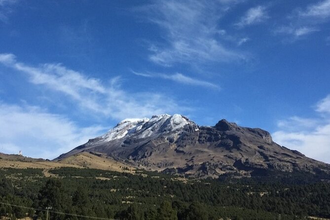
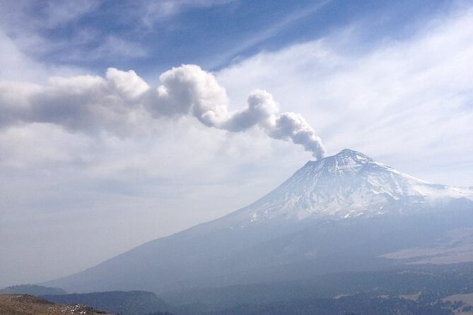
The two volcanoes have very different personalities. Iztaccíhuatl is dormant and ridged, its snowy profile linked to the sleeping woman of Aztec legend. Popocatépetl remains active, and you may see a plume or fumarole rising from its crater. You should never count on an eruption view, since clouds and weather can hide the mountain, but the possibility adds a little drama to the day.
The route does not take you to either summit. Instead, it explores the lower and middle sections of the national park, where you can see the volcanoes without signing up for a mountaineering expedition. That makes the trip a good middle ground between a city day tour and a demanding summit attempt.
You begin at Paso de Cortés, the mountain pass between the volcanoes. From there, the trail heads through forest with Iztaccíhuatl ahead. The group then climbs toward Cerro Altzomoni, a high point with a strong view toward Popocatépetl and its fumarole. After that, you descend toward the Amalacaxco ravine, where vegetation, water, and perhaps wildlife add variety to the route before you return to Paso de Cortés.
More Volcano Hikes in Mexico
- Iztaccihuatl Volcano Hike with an Alpinist
★ 4.0 · 244 reviews - Mexico City: Guided Volcano Trek with Lunch
★ 4.7 · 242 reviews - From Mexico City: Hike Iztaccihuatl Volcano with an Alpinist
★ 4.3 · 155 reviews
What the five-hour hike feels like
The walking is not technically difficult in the mountaineering sense. There is no rope work, glacier crossing, or need to climb toward a summit. Still, you need to be honest about your fitness. A 9 to 13 km day at high altitude is much harder than the same distance in a city park.
You will find dirt roads, rocky paths, ash, forest tracks, and some steep uphill sections. The ground can be slippery, especially where rocks are damp or loose. Dust is another practical issue. Volcanic ash can rise with each step, so a cloth or face covering may help if you are sensitive to dust.
The elevation is the larger challenge. Reports place the route at roughly 3,500 to 4,000 meters, or around 11,800 to 13,000 feet, depending on where you are measuring. One section of the day may feel easy on level ground, then surprisingly hard when the trail tilts upward. You may need to stop often, breathe slowly, and let the guide set the pace.
Guides have been praised for staying near slower walkers and checking on the group. Carlos, Bernardo, Alan, Alberto, Salva, and Sergio are among the names associated with this operation. The level of commentary can vary. Some guides explain the volcanoes, plants, animals, and geography as they walk. Others may speak less unless you ask questions, so do not hesitate to ask about the fumaroles, forest, volcanic ash, or route.
The pace is usually shaped around the group. One group may move quickly, while another takes frequent breaks. The company provides trekking poles, which are useful on descents and loose ground. You also receive a backpack, so you do not need to bring a large daypack of your own.
Paso de Cortés and the climb to Cerro Altzomoni
Paso de Cortés is more than a starting point. It puts you in the space between Mexico’s best-known volcanoes and gives you an immediate sense of scale. The city feels far away, even though the trip began there that morning.
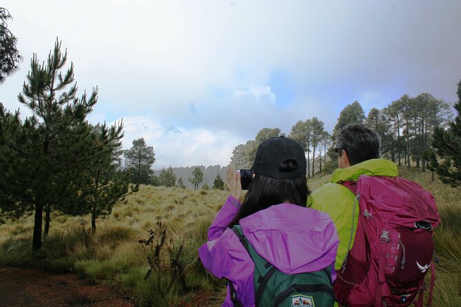
The first section leads through forest with Iztaccíhuatl in view. The trees provide a change from the open volcanic slopes, and the route can feel calm and secluded when the weather is clear. On quieter weekdays, the trail may have very few other groups.
The climb toward Cerro Altzomoni brings the most direct view of Popocatépetl. This is one of the strongest parts of the day because you are not simply looking at a distant mountain from a city terrace. You are standing in the same high volcanic range, with the active peak close enough to dominate the scene.
Clear weather is never guaranteed. Rainy-season clouds can cover the peaks, and wind can change conditions quickly. Even without a perfect volcano view, the high forest, open slopes, and unusual volcanic terrain still make the walk worthwhile. If you want the best chance of sharp photographs, keep your camera ready but do not build the whole day around a clear summit.
Amalacaxco ravine, water, and changing terrain
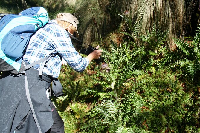
The descent toward the Amalacaxco ravine gives the route a useful change of pace. Instead of walking only through dry high ground, you move through areas with more plant life and the possibility of seeing small signs of wildlife.
A waterfall or glacial stream can appear along the route, with icicles reported in colder conditions. This is one of the trip’s more surprising details. You may start in dry ash and pine woods, then find frozen water and ice-coated vegetation farther along.
The scenery changes with the season. In cold weather, you need warm layers at the start, and temperatures around 8 degrees Celsius have been reported. Later, sunlight and exertion can make the same hike feel warm enough for a shirt. A fleece, jacket, trousers, hat, and sunglasses are sensible basics, with layers allowing you to adjust as the day changes.
The route eventually returns to Paso de Cortés. One caution: a portion of the return may follow a road with passing vehicles. Most of the day’s walking is scenic, but the final road section is less pleasant than the forest and mountain paths. It is worth knowing this before you book, especially if you expect every kilometer to be a wild trail.
Same trailheads, a different kind of day:
- Matacanes : Canyoning + Hiking + Water Jumps + Rappel + Caves
★ 5.0 · 1,497 reviews - Nido de los Aguiluchos, Monterrey: Hiking + Rock Climbing + 3 Rappels
★ 5.0 · 713 reviews - Puerto Vallarta: Full Day Hike to 6 Hidden Beaches & Snorkel
★ 4.8 · 403 reviews - Los Cabos: Hiking at the Fox Canyon with Waterfall
★ 5.0 · 369 reviews
A Mexican lunch that earns its place
After the hike, the group stops at a traditional market or roadside cantina for a Mexican meal. Tacos and quesadillas are included, with options such as squash flower tacos available on some visits. This is more satisfying than a prepacked meal because it gives you a taste of everyday food in the mountain area.
The food carried during the trek is also generous. Your pack includes one liter of water, a 600 ml energy drink, a chocolate energy bar, peanuts, fruit snacks, and a sandwich or similar food item. The exact snack mix can vary, but you should have enough to keep going without buying food along the trail.
Lunch usually comes after several hours of walking, so it feels like part of the reward rather than an afterthought. Bring extra cash if you want to buy something beyond what is included, though the provided meal is intended to be substantial.
Transport from Mexico City and the long day
The pickup point is Av. Vicente Suárez 38 in Condesa, with a 7:00 am start. The activity returns to the same meeting point. The full day can run beyond the advertised nine hours, especially with traffic, stops, and lunch.
The drive to the national park takes about two hours each way. The roads can be winding, so take motion-sickness medicine if you need it. There is a restroom stop during the drive, but facilities are limited at the trailhead and on the route. Carry toilet paper and a little cash for restroom access.
The van is described as comfortable, though taller people may prefer a front seat when available. The long drive is a fair trade for reaching a remote mountain setting, but it is still four hours of the day. If you want a quick outdoor activity, this is not it. If you want a full escape from Mexico City, the travel time makes sense.
Is the $133.34 price fair?
At $133.34 per person, the tour is not the cheapest way to walk in the mountains. You are paying for private transportation from Mexico City, a professional guide, park access logistics, trekking poles, a backpack, food and drinks on the trail, and a full Mexican lunch.
The value improves if you do not have a rental car, mountain equipment, or experience organizing a high-altitude day outside the city. Driving yourself would require handling the long mountain roads, route planning, weather, parking, and the logistics of returning after a tiring walk. Here, those tasks are handled for you.
The small group cap also matters. A maximum of 13 people is large enough to keep the price reasonable but small enough for a guide to monitor the pace. Some departures may be smaller. The guide can pause for people who need more time, though group speed and guide style will vary.
You can usually cancel for a full refund up to 24 hours before the 7:00 am start. Bad weather or failure to reach the minimum group size can also lead to a new date or refund. Since mountain weather affects the views and safety, this flexibility is useful.
Who should book this volcano trek?
You should consider it if you have a decent fitness base and want a real mountain day without attempting a summit. It suits hikers who can manage several hours on uneven ground, repeated uphill sections, and high altitude.
It can also work for families with older children who are comfortable hiking, though you should judge each person’s fitness carefully. Guides have helped slower members of groups, but the day still requires everyone to keep moving.
This is not the right pick if you want a gentle stroll, a short drive, or a guaranteed view of both volcanoes. It is also a poor fit if you have just arrived in Mexico City and do not know how your body handles altitude. Several days in the city may give you some acclimatization, but it does not guarantee an easy hike.
Bring sturdy hiking shoes, layered clothing, sunscreen, sunglasses, a hat, and a face covering for ash and dust. Add a rain layer if the forecast calls for it. The company supplies poles, a backpack, snacks, water, and lunch, but you still need clothing suited to cold wind and changing mountain conditions.
Should you book it?
Book this tour if you want Mexico City’s best mountain escape without arranging your own transport and gear. The strongest reasons are the views between Iztaccíhuatl and Popocatépetl, the quiet forest route, attentive pacing from guides such as Carlos and Bernardo, and the excellent taco-and-quesadilla finish.
Skip it if you dislike long drives, dusty trails, road walking, or strenuous activity at 3,500 meters and above. The hike is manageable for a reasonably fit person, but it is not a casual nature walk. For the right hiker, the combination of volcanoes, forest, waterfalls, high-altitude air, and local food makes the $133.34 price a solid buy.
FAQ
Where does the tour start and end?
It starts at Av. Vicente Suárez 38 in Colonia Condesa, Mexico City, at 7:00 am. The activity ends back at the same meeting point.
How long is the experience?
The tour is advertised at about nine hours, though the full day can last slightly longer. The drive takes roughly two hours each way, and the walking portion usually lasts about five hours.
How far do you hike?
The route may cover about 9 km or 13 km, depending on the option and group. Several descriptions place the total distance near 9 to 10 miles for the longer route.
Is lunch included?
Yes. The food package includes water, an energy drink, snacks, and a sandwich or similar item during the hike. Afterward, you eat tacos and quesadillas at a traditional market or roadside cantina.
Are hiking poles and backpacks provided?
Yes. Trekking poles and a backpack are provided. The backpack carries your lunch, drinks, and snacks.
Can I cancel for a full refund?
Yes, if you cancel at least 24 hours before the experience starts. Cancellations or changes made within 24 hours are not refunded. If poor weather or insufficient bookings cancel the tour, you are offered another date, another experience, or a full refund.
Just added around Mexico
- Hidden Waterfalls Hiking Adventure★ 5.0 · 148 reviews
- Hiking Jorullo Point★ 5.0 · 138 reviews
- Hiking Climbing And Rappelling In The Eaglets Nest★ 5.0 · 31 reviews
- Private Hiking to La M in Chipinque Ecological Park★ 5.0 · 28 reviews
- From Mexico City: Hike Iztaccihuatl Volcano with an Alpinist★ 4.3 · 155 reviews
- Hike and Yoga Jungle Experience in Mexico★ 5.0 · 163 reviews
- Puerto Vallarta: 4-Hour Jungle Hike and Waterfall Swim★ 4.8 · 163 reviews
- 4-Hour Jungle Hike and Waterfall Swim★ 5.0 · 197 reviews
Volcano Hikes, side by side.
Sunrise Mount Batur Guided Hike with Breakfast
Read our review →
Mount Batur Sunrise Guided Hike and Natural Hot Spring
Read our review →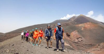
Mount Etna: Summit Guided Hiking Tour up to 3,400 m
Read our review →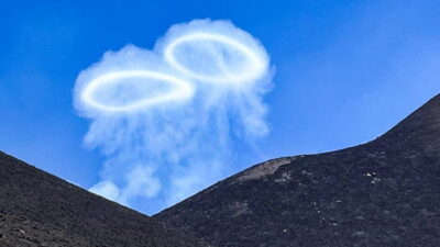
Mount Etna: Trek to 3000m with cable car and 4×4
Read our review →
Mount Batur Sunrise Trek With Guide and Breakfast
Read our review →
Mount Batur Sunrise Hike and Natural Hot Spring Option
Read our review →
Mount Etna: Summit Crater Trek with Cable Car
Read our review →This walk also sits in