
REVIEW · SPAIN
Hiking experience in the High Sierra Nevada National Park
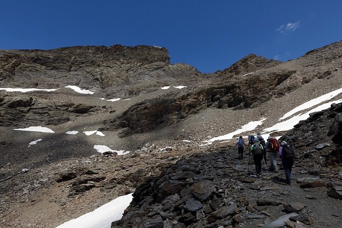
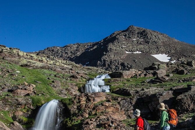
Sierra Nevada gives you a sharp change of scene in less than an hour. You leave Granada’s heat behind and begin walking at about 2,500 meters, through a glacial valley of waterfalls, wildflowers, snow patches, and bare slate. The high point, Tajos del Campanario, rises above 3,000 meters and opens views toward Mulhacén, Veleta, and Alcazaba.
I like the small group of up to eight and the calm pacing. Guides such as Jaime adjust the climb for the people in front of them, stop to explain plants, rocks, wildlife, and mountain history, and keep the day friendly rather than rushed. I also like the pickup and drop-off in central Granada, since you do not need to rent a car or navigate the mountain road.
The catch is simple: this is a serious uphill walk at high altitude, not a casual stroll. Running shoes can work in dry conditions, but sturdy trail shoes with good grip and ankle support are a wiser choice. Bring food, at least 1.5 to 2 liters of water, sunscreen, and layers. Weather changes fast, and equipment availability may vary.
Key points to know before booking
- Start high at 2,500 meters: You begin where the air is already thin, then climb above 3,000 meters.
- San Juan Valley is the scenic heart of the walk: Expect glacial features, streams, waterfalls, flowers, and polished rock.
- The route reaches historic Posiciones del Veleta: Old Spanish Civil War fortifications look across the northern side of the range.
- Jaime is a frequently mentioned guide: He is praised for steady pacing, clear explanations, and patient support, often accompanied by his dog Kai.
- The hike suits fit beginners and regular hikers: You do not need technical climbing skills, but you do need basic cardio fitness and comfort with steep, uneven ground.
- Pack your own mountain lunch: Food and drinks are not included, and the day can last about seven hours including the drive.
Leaving Granada for the high Sierra Nevada
The day begins at 9 a.m. at Plaza de Mariana Pineda in central Granada. Pickup is by private vehicle, and the drive takes you up the Sierra Nevada road toward the trailhead at roughly 2,500 meters.
That transfer is part of the appeal. Granada can be fiercely hot, especially in summer, while the mountains may feel cool and breezy. Several accounts describe city temperatures above 35 C while the trail area felt closer to 22 or 23 C. You still need sun protection, but the change in air is welcome.
Sierra Nevada is the highest mountain range in mainland Spain. Its name means Snowy Mountain Range, and its Muslim name, Sulayr, means Mountain of the Sun. Fifteen peaks rise above 3,000 meters, including Mulhacén at 3,482 meters, the highest point on the Iberian Peninsula.
You do not climb Mulhacén on this outing. Instead, the route heads into the San Juan Valley and toward high viewpoints around Tajos del Campanario. That gives you a full mountain day without committing to a summit route that would require more time and preparation.
More National Park Hikes in Spain:
- PRIVATE TOUR Teide National Park: Hiking and Stargazing
★ 5.0 · 38 reviews - San Francisco: Yosemite National Park & Giant Sequoias Hike
★ 4.5 · 1,777 reviews - Skaftafell National Park: Falljokull Glacier Advanced Hike
★ 4.8 · 1,083 reviews
Walking through the glacial San Juan Valley
The first major section follows the San Juan Valley, described as one of the most beautiful glacial valleys in Sierra Nevada. Here, the story is written in the rock. Ice shaped the valley over thousands of years, leaving hollows, smooth stone, high slopes, and water routes that still define the walk.
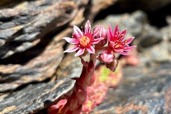
This is where a good guide adds real value. Jaime and other guides used on the outing explain the local plants, insects, rock formations, and mountain ecology. The area contains species found only in the high Sierra, and migratory birds cross between Africa and Europe.
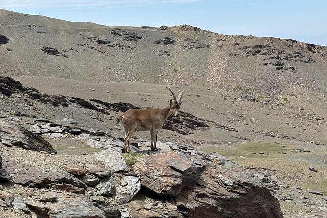
Keep your eyes open rather than expecting a wildlife show. Mountain goats are among the most likely large animals to spot, while eagles and vultures may circle above. You might also see cattle, sheep, horses, or patches of snow late into the season. One outing in June included snow, goats, cows, horses, flowers, and a waterfall.
The valley is not all gentle walking. The trail can turn rocky and uneven, and some sections use loose slate. In wet or windy weather, those stones become more slippery. Hiking poles help with balance, especially on the descent, when tired legs make loose rock less forgiving.
Posiciones del Veleta and the mountain’s wartime past
Partway through the walk, you reach Posiciones del Veleta. Fortifications built during the Spanish Civil War remain on this high ground, looking over the northern face of Sierra Nevada.
This stop gives the hike a human layer without turning it into a formal history tour. You are standing among mountain rock and snowfields while also seeing traces of a conflict that shaped modern Spain. The views extend toward Veleta and the upper ridges, with snow sometimes remaining through the warmer months.
The high setting matters here. At this altitude, the air can feel cool even after a hot morning in Granada. Wind may rise without warning, and clouds can change the mood of the route in minutes. Pack a light waterproof or windproof jacket even if the forecast looks settled.
Guides have supplied extra gloves, hats, beanies, warm clothes, and rain ponchos when conditions turned rough. That support is useful, but I would not treat borrowed gear as guaranteed. Bring your own layers and rain protection, then consider any loaned equipment a welcome backup.
The climb above 3,000 meters
The hardest part comes as you gain more height toward Tajos del Campanario. The exact effort depends on your pace, the weather, and the condition of the trail, but the climb is commonly described as moderately strenuous, with two to three hours of uphill walking including breaks.
The altitude makes the climb feel harder than the same slope at sea level. You begin at 2,500 meters and work toward more than 3,000 meters, so short breaks are normal. A fit 19-year-old and a less active 66-year-old can enjoy the same outing when the guide sets a sensible pace, but both should expect real exertion.
You do not need technical mountaineering ability. The route is at most minimally technical, yet it includes steep stretches and loose rock. If you exercise regularly through running, cycling, swimming, tennis, or similar activities, you are more likely to enjoy the effort. If you rarely exercise, this may feel like a demanding day.
The guide keeps the group together and makes several stops. If you become too tired, there are places where you can wait while the rest of the group continues and returns. That option makes the outing more flexible, but it does not turn the route into an easy walk. You should still be comfortable spending several hours outdoors at altitude.
More hikes and treks around Spain:
- La Palma: Tajogaite Volcano Guided Trek
★ 4.8 · 1,810 reviews - From Valencia: Montanejos Guided Hike with Natural Pools
★ 4.5 · 1,741 reviews - From Seville: Caminito del Rey Hike Day Trip
★ 4.5 · 1,240 reviews - Lanzarote: Hike Across Timanfaya’s Volcanic Landscapes
★ 4.8 · 1,234 reviews
Tajos del Campanario and the high views
At the top of Tajos del Campanario, the reward is a broad view across the northern Sierra Nevada. You can see the north faces of Mulhacén, Veleta, and Alcazaba, with snowfields often holding on in the high folds of the range.
This is a stark setting rather than a soft, green mountain meadow. The upper slopes are rocky, exposed, and often windy. That severity is exactly what makes the view memorable. You see the glacial shapes from above and understand how much climbing brought you there.
The route is especially appealing if you want mountain silence. Some groups have encountered very few, or no, other hikers during the walk. The small party, remote trail, and wide views create a sense of space that is hard to find in Granada’s busy center.
Plan to eat your lunch near the high point or at another suitable stop. Food and drinks are not included. A sandwich, nuts, fruit, and plenty of water are practical choices. One useful target is 1.5 to 2 liters of water per person, adjusted to the weather and your own needs.
The guides, pace, and group size
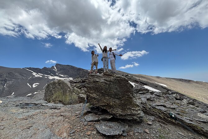
The maximum group size is eight, which is one of the strongest features of this outing. A small party lets the guide hear individual concerns, adjust the pace, and stop without holding up a large crowd.
Jaime receives especially strong praise for his calm manner, mountain experience, and patient support. He explains the area without turning every pause into a lecture and can speak English and Spanish. His dog Kai often joins the group, adding a cheerful companion on the trail.
Other guides, including Buitre, Jesus, and Duab, have also led outings. Buitre was noted for keeping a manageable pace and making the walk relaxed and fun. Jesus was described as patient with different fitness levels. The guide name assigned to your date may vary, so do not book solely on the assumption that Jaime will lead your group.
The guide’s role matters most when the conditions shift. Rain, wind, snow, and loose slate can make a straightforward path more awkward. Good route judgment and steady encouragement are worth more here than a fast pace.
Shoes, poles, clothing, and what to pack
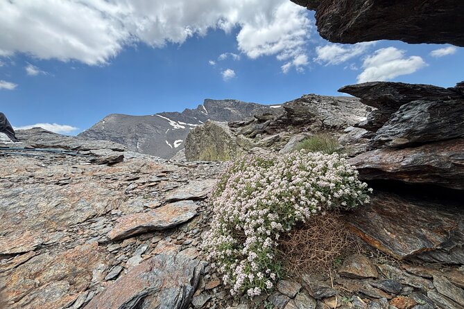
The operator says sneakers or trainers are acceptable, and some people complete the hike in running shoes. Still, I would choose trail shoes or hiking boots with firm grip if you have them.
One person found ordinary sneakers slippery on loose rock. Another wished for ankle support after wet weather. You do not need heavy mountaineering boots, but thin-soled city shoes are a poor match for steep slate and uneven ground.
Hiking poles are useful on both the climb and descent. They are listed as included, and several outings had poles available. One account, however, found that not enough poles were provided on a particular day. If poles make you feel secure, confirm availability before departure or bring your own if practical.
Pack:
- A light jacket and a waterproof or windproof layer
- Long activewear trousers or other comfortable hiking clothes
- Trail shoes or hiking boots with grip
- Sunscreen and a hat
- At least 1.5 liters of water, preferably closer to 2 liters
- Sandwiches and small snacks
- Gloves or a warm layer if you are hiking early or late in the season
The company says warm clothes can be provided, but I would plan as if you need to bring your own basics. Mountain weather can ignore the forecast.
Is $71.35 good value?
At $71.35 per person, the price is reasonable for a seven-hour outing that includes private transport from central Granada, a UIMLA mountain guide, insurance, and a small group capped at eight.
The value is strongest if you do not have a car. Driving the Sierra Nevada road yourself means dealing with mountain roads, trail access, parking, weather, and route decisions. Here, you can focus on walking while the driver handles the transfer.
The cost does not include lunch or drinks, so add those to your planning. It also does not guarantee that every item of clothing or footwear will be available in your size. If you need loaner boots or special equipment, contact the provider several days ahead and get clear confirmation.
For a city break, this is a good use of a day if you want exercise and scenery rather than another monument. You lose most of a day in Granada, but you gain a direct look at one of Spain’s great high-mountain areas.
Who should book this Sierra Nevada hike?
I would choose this outing if you enjoy walking, want a cooler break from Granada, and like learning about plants, wildlife, geology, and local history along the way.
It fits regular exercisers, experienced hikers, and reasonably fit first-time mountain walkers who understand that altitude adds difficulty. It also works well for mixed groups, since the guide can slow down and offer rest points.
I would think twice if you want a gentle nature walk, dislike loose rock, or have no interest in uphill exertion. The route is not a technical climb, but it is long, exposed, and physically demanding in places.
Free cancellation is available up to 24 hours before the 9 a.m. start time. Poor weather can lead to a different date or a full refund, which is important for a high-altitude outing.
Should you book it?
Book this hike if you want the real mountain day: cold air above Granada, glacial rock, snowfields, wildlife, wartime ruins, and a hard-earned view toward the highest peaks in Iberia.
Skip it if you want guaranteed sunshine, a flat trail, or a relaxed sightseeing excursion. For everyone else, the combination of central pickup, a small party, flexible pacing, and guides such as Jaime makes this one of the better ways to reach high Sierra Nevada without arranging the whole day yourself.
FAQ
Where does the hike start?
Pickup begins at Plaza de Mariana Pineda in central Granada at 9 a.m. The vehicle then drives to the Sierra Nevada road at about 2,500 meters.
How long does the experience last?
The full outing takes approximately seven hours, including transport. The hiking portion is generally around five to six hours, depending on the group and route conditions.
How high does the hike go?
The walk begins at roughly 2,500 meters and climbs above 3,000 meters toward Tajos del Campanario.
What can I see on the route?
You may see glacial rock formations, lakes, waterfalls, streams, wildflowers, mountain goats, eagles, vultures, migratory birds, and high-altitude plants and insects. Snow can remain on the upper slopes during warmer months.
Do I need hiking boots?
Trainers can be used, and some people complete the walk in running shoes. Sturdy trail shoes or hiking boots with good grip and ankle support are a better choice for loose, wet, or uneven rock.
Is food included?
No. Food and drinks are not included unless specifically stated. Bring lunch, snacks, and at least 1.5 liters of water.
How many people are in the group?
The maximum is eight people. The guide sets the pace and makes stops along the route.
What happens if the weather is bad?
The experience requires suitable weather. If poor weather causes cancellation, you will be offered another date or a full refund. Free cancellation is also available up to 24 hours before the start time.
Just added around Spain
- From Valencia: Montanejos Tour with Guided Hike★ 4.1 · 86 reviews
- Montanejos Hiking Tour & Thermal Pools from Valencia★ 4.5 · 111 reviews
- From Valencia: Cala del Moraig Hiking & Beach Trip★ 4.8 · 107 reviews
- Trekking in the Volcanoes Natural Park in a small group★ 5.0 · 97 reviews
- Montserrat very early : Hiking, Abbey, very small group★ 5.0 · 127 reviews
- PRIVATE TOUR Teide National Park: Hiking and Stargazing★ 5.0 · 38 reviews
- Semi-Private Montserrat Monastery & Hiking Experience★ 5.0 · 132 reviews
- Private Pre-Pyrenees Medieval Village Hike from Barcelona★ 5.0 · 39 reviews
National Park Hikes, side by side.
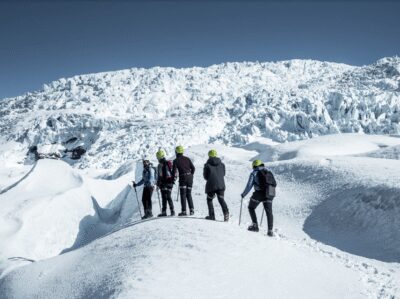
Skaftafell National Park: Falljokull Glacier Advanced Hike
Read our review →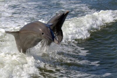
Everglades National Park Biologist Led Adventure: Cruise, Hike + Airboat
Read our review →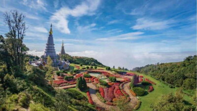
Doi Inthanon National Park and Pha Dok Siew Trek
Read our review →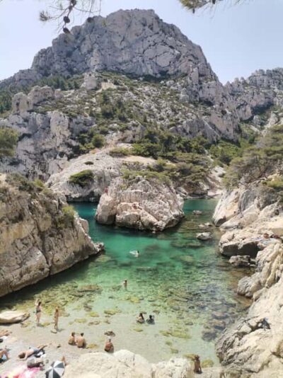
Marseille: Calanques National Park Guided Hike with Picnic
Read our review →
From Marseille: Calanques National Park Guided Hike
Read our review →
From Kuala Lumpur: Taman Negara National Park Trek Day Tour
Read our review →
This walk also sits in